Hall’s Creek Canyon at Ravenden Springs

Naturally speaking, the most interesting place in northeast Arkansas is right here in Randolph County: Hall’s Creek Canyon. For the adventurer, exploring Halls’ Creek Canyon can be a real treat! The canyon is in a wilderness area right at the edge of the town of Ravenden Springs. Turn right off Hwy 90 onto Upper Janes Creek Road, and cross the bridge over the canyon.
If you go down into the canyon, it’s recommended that you wear hard-sole hiking boots stiff enough for walking on jagged rocks, and waterproof enough for some ankle-deep wading. A walking stick might also be helpful, and insect repellent might help during tick and chigger season.
If you’d like a longer hike, immediately after crossing the bridge, turn right to park beside the bridge. If you’d like a shorter hike, turn left at the first road after crossing the bridge, and drive a short distance down the asphalt street. At the point where the asphalt ends, there’s a turn around loop where you can park.
 If you started your adventure at the bridge, in front of you is Hall’s Creek and Bailey Spring, across the creek at the foot of the steps. Bailey Spring is the largest of the five springs with medicinal qualities that made Ravenden Springs a popular spa in the late 19th and early 20th centuries. There’s still a water hydrant at the base of the spring, about a foot off the ground, where you can draw fresh water from the spring.
A little farther upstream you can take a fork to the right up a side creek and, at the first bend up the side creek you’ll find the stone base of the “Eye Spring” that was said to cure eye ailments. The springs were enclosed to capture enough water so visitors could fill jars with the spring water for carrying home.
After visiting the spring, turn right (southwest) and travel along the creek in the downstream direction. One can hike in the creek bed when the water’s low or along the creek bank at other times.
If you started your adventure parked at the loop downstream from the bridge, you’ll find a couple of steep trails from the canyon rim leading down into the canyon. Take the trail to the left to go down. Later, you’ll use the trail to the right to climb back out of the canyon and return to your car.
Soon hikers will notice rock formations climbing steeply upward on both sides of the creek. Waterfalls, pools, and torrents also begin to characterize the creek. Some pools are large and deep enough for a refreshing swim. As one travels on down the creek, the rock bluffs on each side get higher and steeper, and many of the unique features of the canyon begin to appear.
These include the documented site of Arkansas’s first school. In 1817 Caleb Lindsey started a school there for the area’s children. The school “building” still stands because it was a cave. The School Cave is approximately a quarter-mile below the bridge. It’s on the southeast side of the canyon just below the concrete dam built across the creek in the 1930’s to create a swimming hole. Beside the cave is the Blue Pool, also called “The Devil’s Bathtub”–it’s said to be bottomless. To reach the School Cave, hikers must travel along the northwest side of the canyon, climb up an easy slope and down a slightly steeper slope below a large rock that’s detached from the canyon wall. This is probably the only even slightly challenging part of the hike down the canyon other than having to walk over small rocks along most of the route. If you enter the cave through the large front opening, look to the right once inside the cave and you’ll see a tunnel through the rock that can serve as a secondary method of entering and leaving the cave. (The story continues beneath the map below…)
GPS location of the parking area: 36° 19′ 03.55″ N 91° 13′ 32.63″ W
View Larger Map
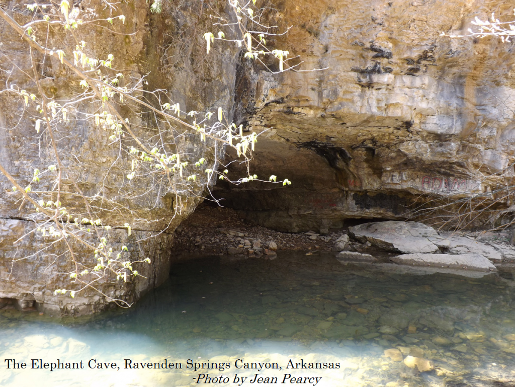
Another quarter-mile down the canyon, one comes to two caves on the northwest face of a tall rock bluff. At the base of the bluff is the Elephant Cave, so named for its large size. Above the Elephant Cave on the face of the bluff about 20 feet up is another cave. This is the Raven’s Den. It’s hard to see when the trees are leafed out. Early explorers of the canyon reported that ravens–crow like (but larger) birds nested there in the cave. Whether they didn’t know the difference in a raven and a crow or there actually were ravens in this area then (early 1800s) isn’t known, but ornithologists tell us that it’s unlikely that the raven (a bird of western North America) lived here at that time.
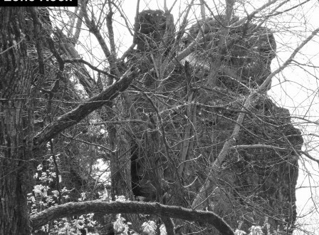
Just a bit further down the canyon, one comes to two other primary features located on the southeast side of the canyon. As one approaches Lone Rock, one can clearly make it out before arriving at its base. This is a tall column of rock that has separated from the rock of the canyon wall–quite an impressive site. Just past Lone Rock is another feature that can be interactive if one chooses, the Needle’s Eye. This feature is a large crack or fissure in the solid rock bluff from the bottom of the canyon to the top. The Needle’s Eye may be climbed without too much difficulty–it’s a moderately difficult climb for youngsters (adult accompaniment is recommended). Climbing the Needle’s Eye is a unique experience that most locals have done at least once, probably more often. When reaching the top, one is also near the top of Lone Rock. Though the distance from the top of the bluff to the rock column isn’t great, jumping from one to the other isn’t recommended–it would be a deadly fall if the jumper failed the attempt.
While that covers the main features of the canyon, the entire hike of a half mile or so each way has much natural beauty and interesting rock formations all along the way. Just below the Needle’s Eye, the canyon walls begin to slope down from the top more gently. These rocky slopes are thick with moss and redbud trees–a beautiful sight in the spring when the mosses are bright green and the trees are covered with purple blooms.
To return to your starting place, just reverse your course. Just upstream from the Elephant Cave you’ll find a steep trail that makes for an easy climb out of the canyon, up to the rim and the asphalt loop where you may have parked your car, unless you parked down the street a short distance, near the Bailey Spring.
One Reply to “Hall’s Creek Canyon at Ravenden Springs”
Leave a Reply
You must be logged in to post a comment.
High canyon walls, Arkansas’s first school, caves, waterfalls, great scenery–the canyon has it all. A great hike for all ages.